Category: Pacific Crest Trail

  • Day 133 – Swinging Bridge

    Day 133 – Swinging Bridge

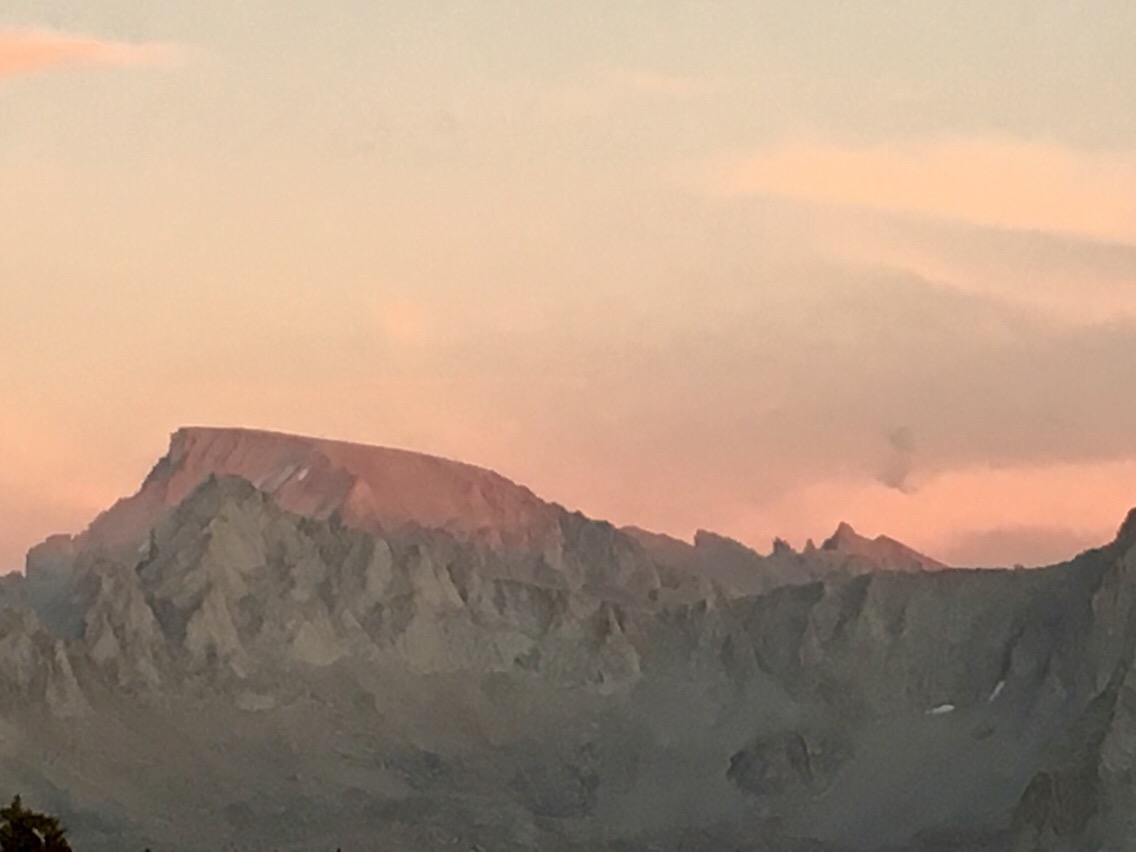
    At mile 815.6. Hiked 21.3 miles today.

    I climbed over 3500 vertical feet from the swinging bridge to Pinchot Pass. I climbed again to a point just below the final climb of Mather Pass. 

    Here is a rock formation that looks like a giant thumb. Last night I camped close to this dome. This view is looking back after hiking beyond camp for a short while.

    Here are some of the many mountains I have been seeing.

    Only one person at a time is allowed on this swinging bridge over the King River. I can see why. The bridge undulates backward and forward, but the floor also tilts steeply from side to side. This combination of motion could easily throw you into the river if you don’t hold on. Finally, I found a fun swinging bridge that beyond doubt undulates, tilts, and swings. 

    I stopped for a late lunch below Pinchot Pass. I took a nap but didn’t realize that a pack party was just beyond the rise behind me. I kept hearing sounds of something hitting rocks. It was this mule team shuffling in place as the party ate their lunch. It is a good thing these mules didn’t bray. A loud bray would have really startled me from my half nap. A short time later I stopped for a break at the top of Pinchot Pass. A couple of other hikers wandered up and joined me for a break. One of the hikers actually worked for the “pack party” and was currently trailing the pack team. Her job was to hike along and be present to help out the paying customers. Sounds like the perfect job. I asked her questions about how much guided packing trips on the JMT cost.   It cost nearly as much as it probably cost me to hike from Mexico to Canada. I would love to take a horse and a mule out on the JMT. I would ride the horse and pack the mule. I would also wear a cowboy hat. 🙂

    Here are some views below Mather Pass where I camped.

    Tonight I am camped on the barren tarns below Mather Pass.

  • Day 132 – Rae Lakes

    Day 132 – Rae Lakes

    At mile 794.3. Hiked 5.4 PCT miles today. Returned to PCT via Kearsage Pass Trail by hiking additional 7.2 miles.

    I bought 2  breakfast burritos at the Shell Station in Independence to carry with me for lunch. The person working in the store seemed strange. When I asked how much my food cost he seemed to just make up an obviously inflated price. Then he quickly reduced it by a dollar. Observing this pricing system, I asked how much the Cliff Bars were. Again, he threw out a price, immediately reducing the price, then reducing it again. I saved the burritos until just before I began my climb of Glen Pass. Coming down the other side of Glenn Pass, my mind was zoned out. As my mind zoned into a complete blank, my focus became deeply set on stepping through the rocks. Normally while hiking, I think of a variety of things. This time I felt outside my body. When I spoke to others it felt like the words weren’t coming from me. I began to wonder whether something was added to those burritos other than eggs and cheese.

    Here I am hitchhiking to Onion Valley on this deserted road. After a long wait and two missed chances,  I waved a $20 bill when the third driver looked like he would pass. He stopped when he saw the $20 bill.

    Over Kearsage Pass, I took the high route back to the PCT. I looked down upon the lakes that I had walked alongside two days earlier via the low route.

    I love to see horses and mules packing supplies. I could see myself doing this.

    Another lake view from Kearsage Pass Trail.

    Here is the trail to Glenn Pass.

    This is the top of Glenn Pass.

    Lake over the north side of Glenn Pass. The trail leads into Rae Lakes following a very rocky and hard to walk route.

    Some pics of lakes and Rae Lakes.

    I became tired and stopped early at a site that had a bear box. The bear box was handy because I had a lot of food that could not fit in my bear vault. I should have been able to hike another 3 or 4 miles, but it was still a productive day. I felt good about the day considering that I didn’t start hiking until 10:25 am and that I had crossed two high passes including Glenn with its brutal rocky surface.

  • Day 131 – Zero in Lone Pine

    Day 131 – Zero in Lone Pine

    At mile 788.5.

    Here is a view of Mt Whitney from a booth at McDonald’s in Lone Pine. Whitney is the peak just to the left of the lamppost. Because it is set back, it isn’t prominent on the skyline above Lone Pine.

    I stayed at the Dolly Villa again and the big excitement of the day was a purchase of a new Montbell down parka. The post office lost my bounce box with my warm clothing and the nights are getting colder. 

    (Note: Months later I received my bounce box at my home in Roswell, Georgia. It wasn’t the postal service’s mistake. I had thought I sent my bounce box to Stehekin. I had actually sent it to Skykomish.) 🙁

  • Day 130 – Forester Pass

    Day 130 – Forester Pass

    At mile 788.5. Hiked 15.8 PCT miles plus 7 miles on Kearsage Pass Trail to Onion Valley parking lot.

    Today I climbed 2 passes including Forester Pass at over 13,000 feet, the highest point on the PCT.

    I came across many families of Marmots. This is an adult. The babies are cuter. 

    Here is the climb up Forester Pass. You can see the notch that is the pass.

    Here is the view looking back (south) from Forester Pass.

    A lake after the initial descent from Forester Pass.

    Just one of the countless views, all worthy of stopping for a break or photographing. I wouldn’t hike a mile in a day if I stopped whenever I was captivated by the view.

    Here is one of many lakes along the trail over Kearsage Pass. I hiked 8 miles down this trail in order to hitch a ride to Lone Pine for resupply.

    The clouds built as I began climbing Kearsage Pass. I kept an eye out for lightning danger. The climb was steep on the west side of the pass.

    This is the top of Kearsage Pass.

    On the east side of the pass, the trail was not as steep but it descended forever and toward the end had many steps that were 12 inches or higher. Stepping down these at the end of the day was harder on my knees.

    Another view along the Kearsage Pass Trail to the parking lot at Onion Valley. After all my effort to reach the trailhead, I couldn’t get a ride into Independence and was forced to camp at Onion Valley. I had to pay $20 for a campsite without running water. Hopefully, the money will be put to good use by the National Park Service. At least I am getting free admission at many National Parks by hiking into them, so paying $20 today isn’t so bad after all.


  • Day 129 – Mt Whitney

    Day 129 – Mt Whitney

    At mile 772.7. Hiked 6.4 PCT miles today plus 15 miles to Mt Whitney summit and back plus 0.8 miles to return to the PCT. Total distance hiked today was 22.2 miles.

    I was cold in the sleeping bag when I awoke to see that the ground had frozen.

    I was up at 3:35 am and on the trail to Mt Whitney just after 4 am.

    There was a nearly full moon so I left my headlamp turned off most of the time. Without the headlamp beam, I could actually see more of the surroundings. While the headlamp was on, I could only see the trail. Just to my left, I spooked a large animal, causing a loud scattering of rocks. Switching on my headlamp I saw that it was a large buck sporting an enormous rack of antlers. Once again extinguishing the headlamp, I gazed at the white cliffs and mountains rising around me. Stars and planets shone above the line where the sky joined the darkened mountains. The lower corner of Orion laid just above the mountain in my path. In the moonlight lakes and meadows were darker pools of calm.

    The trail crested above Guitar Lake where I could spy distant headlamps just beginning to form in small groups and move out in lines. Tents around the lake glowed like lamps marking where others were still waking and packing for their turn to join the early morning ascent of Mount Whitney. As I moved through the lines of slowly moving headlamps, people thought it strange that I walked in the dark. Some wrongly assumed I didn’t have a headlamp. I thought it strange that they used headlamps on such a brightly lit and beautiful night.

    I started climbing with Guitar Lake below me.

    Many switchbacks later, I reached the junction with the Whitney Portal trail that ascends from the desert floor eastern approach. Soon after, I passed these 2 pinnacles. Only a few days earlier, while roaming the streets of Lone Pine, I had used these features to pick out Mount Whitney.

    On top of Whitney.

    Here is proof that I made it to the top of the highest point in the lower 48. After hiking a few thousand miles, I must truly be in great physical shape, because I was never out of breath for the entire climb. I arrived before 8 am after hiking 7.5 miles in less than 4 hours. It did feel great not having to carry a loaded backpack.

    The pinnacles next to Whitney.

    A view looking down toward Guitar Lake.

    On the return trip to Crabtree Meadows, I was able to see by sunlight that which I had seen by moonlight. Here is Timberline Lake. I climbed on the rock you can see in the photo centered among the reeds. From this rock, I pushed off for a short swim in this very cold lake. When I stepped on the rock I saw that a snake was already there enjoying that sunny spot. Snake number 19? 20? Not sure.

    Another view of Timberline Lake.

    After a nap in my tent, I broke camp and hiked further on the PCT. Here is a late afternoon view.

    Here is my tent set up on Big Horn Plateau. It was a cold spot with frost all over the next morning. Also, a great view of Whitney in the distance. At the end of the day, it’s nice to see where you have been.

  • Day 128 – Cold Start

    Day 128 – Cold Start

    At mile 766.3. Hiked 15.5 miles today plus 1.2 miles on Crabtree Meadows trail. August 27, 2018

    I’m seeing a lot more people now. Most of the hikers are out to climb Mt Whitney. Some are hiking the John Muir Trail. I met one hiker who told me he was giving up. He had started at Cottonwood Pass with intent to hike the JMT northbound. After 20 miles he is hiking back to Cottonwood Pass. He told me that he had gotten dehydrated. 

    The heat is real. It is bothering a lot of hikers slower than me because they are exposed longer and take longer to reach water sources. After today everything north is supposed to have frequent water.

    It may be hot during the day, but it is cold at night. I had to zip my sleeping bag the whole way and close the tent doors. I’m guessing that it was around 35 degrees at Chicken Spring Lake where I camped last night. I began hiking this morning wearing literally all the clothing I have. That included long silk underwear, long pants, down vest, wool hat, and precip rain jacket. This is the coldest it has been since Oregon.

    The cold morning had me out of camp and on the trail early just to warm up. Here is a photo before the sunrise.

    I watched the moon as it neared setting.

    It was a blue sky day without a cloud.

    Here is the daily trail photo.

    I passed through wide-open meadows.

    And more meadows.

    Here is the toilet at Crabtree Meadows. With many hikers camping at Crabtree Meadows while on the way or returning from a summit of Mount Whitney, this single toilet sees a lot of use. It is wise to do your business before you begin your Mt Whitney ascent. Those climbers exiting via Whitney Portal are required to pack out their “waste” in a blue bag.