Category: Hiking

  • Day 5 – More miles than planned

    Day 5 – More miles than planned

    We planned on a 15 mile day, but ended up hiking 16 miles to Mountain Meadows Lodge. Turns out that Thundering Brook road crosses the trail twice and we had picked out the wrong one. What’s another mile when you are hiking 15 miles.


    Today I was on stride. Felt good all day. Cooler weather and dry socks might have helped. Used some moleskin on some blisters from yesterday and feet did well.

    I went off trail twice. First, we lost the trail while leaving Winturi Shelter on the blue blaze. Using Guthook we bushwhacked back to the shelter trail. Not a good start. Next, I missed the trail when cruising the last half mile trail. Backtracked and Sheffy never missed me.

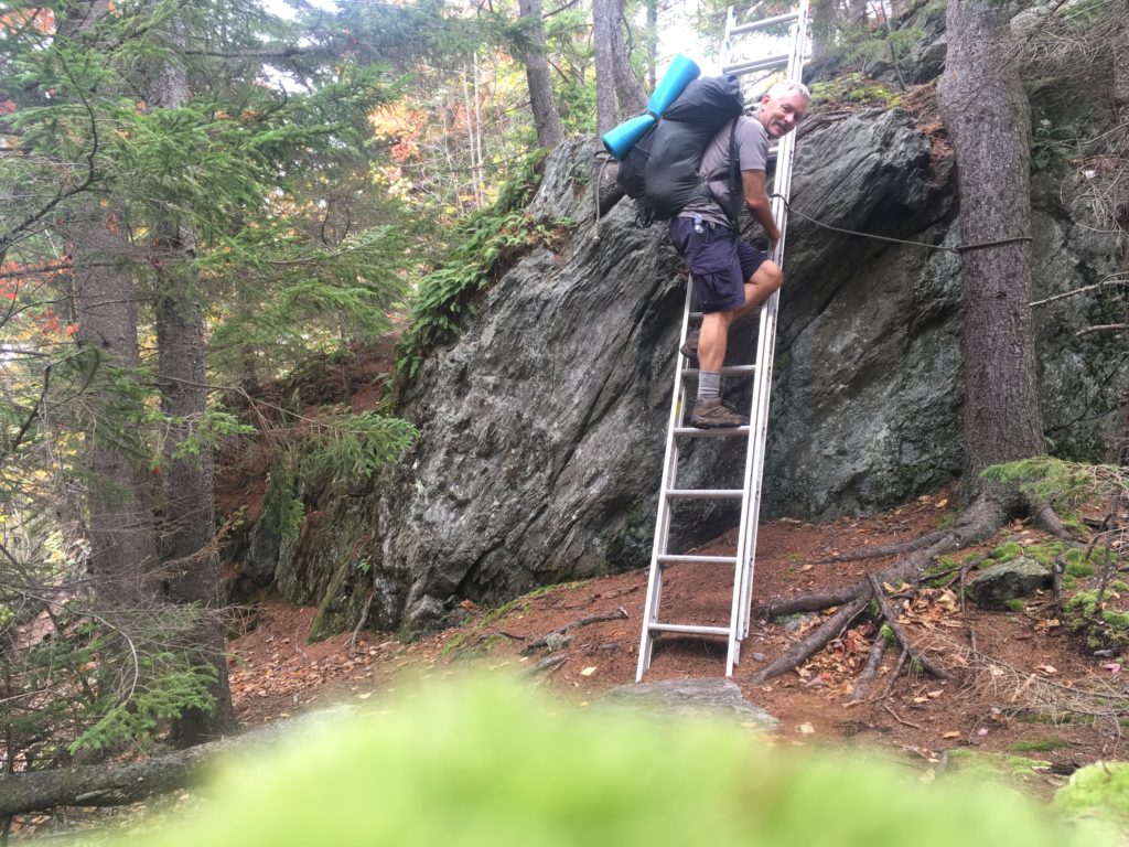
    Had fun climbing this trail ladder.


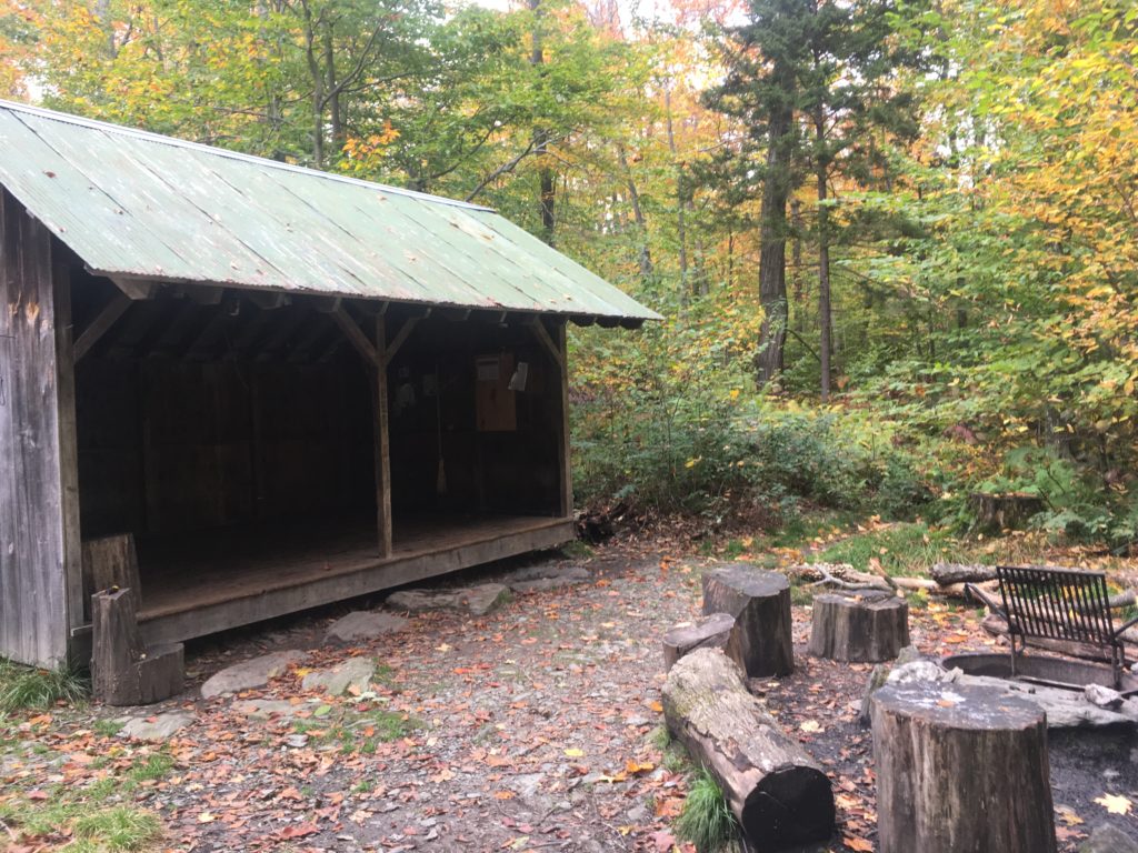
    Stony Brook Shelter where we had a short lunch.

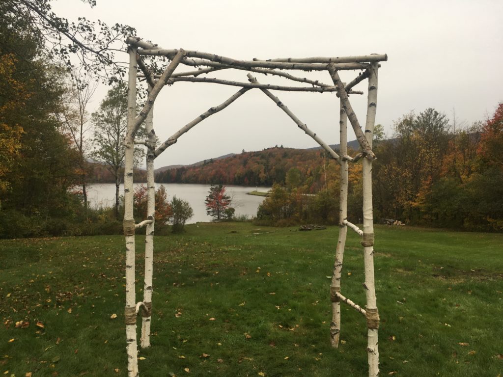
    I helped move this wedding trellis in return for a ride to the Deli store.

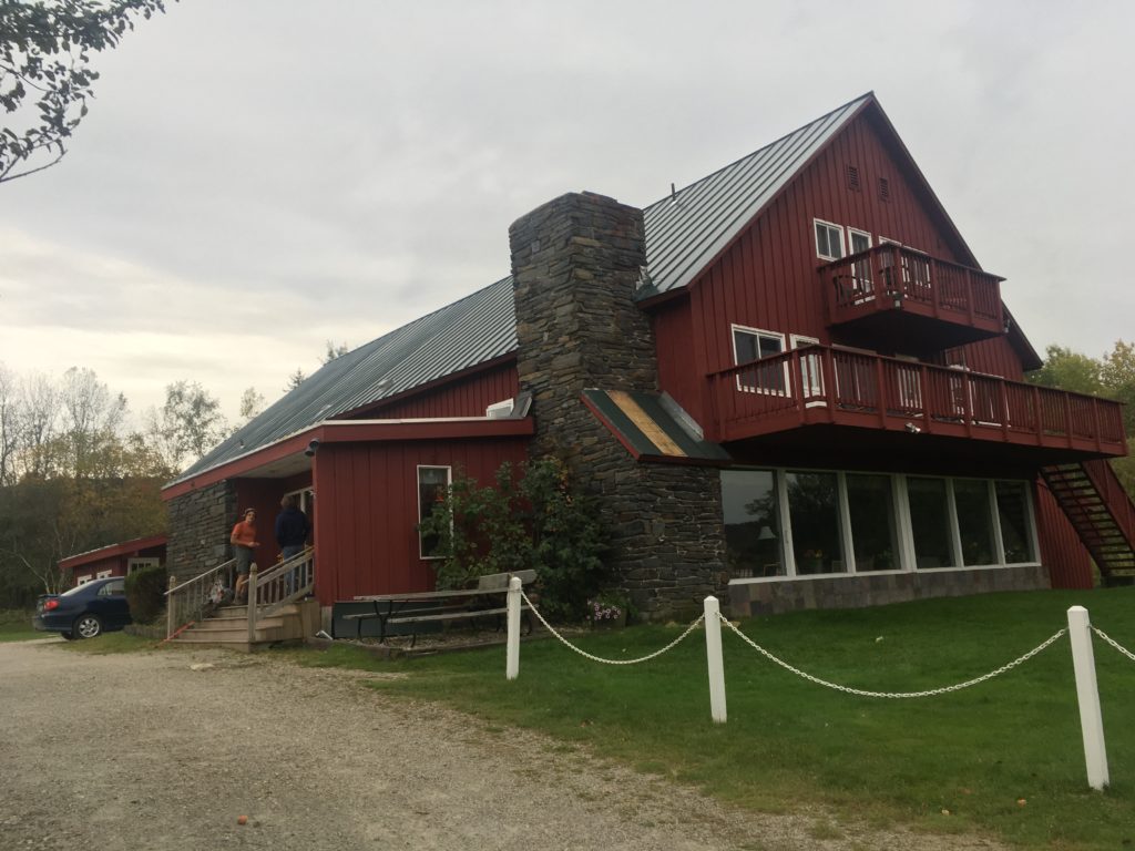
    Mountain Meadows Lodge: Hot showers, laundry, room, pizza delivery,  and breakfast.

    Thundering Brook Falls

    (more…)

  • Day 4 – A hard day on the AT

    Day 4 – A hard day on the AT

    The sun came out. Only 12 miles today, but they were tough. Hiked from Thistle Rock Shelter to Winturi Shelter. After 2 strenuous days, the sore muscles showed up on this shorter day. I also started getting blisters from the wet socks and steep descents.

    We are at Winturi Shelter. Piper showed up. Later after dark Shaker rolled in followed by Beast about 10 minutes later. Sheffield and I are tenting, rather I am tarping. A limb fell nearby last night. With better weather hopefully the limbs will stay on the trees tonight.

    Another salamander today.

    Winturi Shelter – I tarped outside the shelter.

    (more…)

  • Day 3 – Rain and More Rain on AT

    Day 3 – Rain and More Rain on AT

    We woke up to rain and packed quickly to hike into Hanover for breakfast and resupply. It was a wet 16 mile day from Velvet Rocks Shelter to Thistle Rock.

    Stopped  at Happy Hill Shelter for lunch where we met Beast, Shaker, and Woods Strider. Beast and Shaker were were with us for the night at Thistle Rock Shelter.

    Not much to report. Tough day. Sleeping in shelter tonight in order to dry out.

    Here is another salamander. They must love the rain.

    The trail leaves New Hampshire and enters Vermont on this bridge in Hanover.

    View toward bridge from Hanover. It really rained a lot during road walk.

    Here is a bench to rest on after the first tough climb in Vermont. There were more climbs to go before reaching shelter.

    Now i am sitting in dry Shelter writing this blog. It is 8 pm, my stomach is full, I have dry sleeping clothes on, an de the rain is pattering loudly in the tin roof. Hurricane Nate was set to track over us at 7pm.

  • Day 2 – New Hampshire AT

    Day 2 – New Hampshire AT

    • It was warm and humid and my shirt was soaked in sweat by the time I topped out on the first climb of 1200 ft. We had a few periods of rain. The trail became mostly easy but I was still worn out by the time I covered 15 miles.

    Here is where we ate lunch. Moose Mountain Shelter.

    We topped off water here but we were running low by the time we reached Ledyard spring, near Velvet Rock Shelter.

    Here is spring and sign.

    This salamander came out at night. He was living under the Rick we cooked on.

    Here are some nice photos from the day.


  • Day 1 – New Hampshire AT

    Our first day was a tough one. Not really. We covered 0.8 miles of the AT from Dorchester road to Trapper John Shelter. Our enthusiastic shuttle driver, Chis the geologist quickly filled us in on the 100 million year history of the area. The rain had stopped. Sheffy and I made our way uphill. I organized my cluttered pack, we set up tents, and were glad we did when we saw a bold shelter mouse. After dinner of red beans, rice, tofurkey sausage, and mashed potatoes, all mixed we had company. Mrs Claus and Jen arrived after wrapping up a 17 mile day. That didn’t help our ego after our pitiful 0.8 mile day.

    We retired to tents to listen to books and write blogs.

    Trapper John Shelter

  • Trail Guide – Mitchell Lick Trail No. 154

    Trail Guide – Mitchell Lick Trail No. 154

    Trail Guide – Mitchell Lick Trail No. 154 (2.5 miles)

    From signed intersection with King Meadows Trail near Hooper Bald, Mitchell Lick Trail frequently follows old logging roads approximately 2.5 miles to a signed (barely legible and rotten sign) trail junction at the upper end of Snowbird Creek trail.  Mitchell Lick Trail allows for a nice overnight hike using King Meadows trail to make a loop that includes the entire length of Snowbird Creek trail.  A side trip to the top of Hooper Bald would be a worthwhile addition to the loop hike. Another side trip to Sassafras Falls should be considered. Mitchell Lick Trail is seldom hiked and can be difficult to follow at times.  The heavily wooded trail maintains elevation above 4000 feet as it crosses below ridge tops as it occasionally dips down to creeks during its cross slope traverse between the lower slopes of Hooper Bald and the headwaters of Snowbird Creek.


    Areas: Snowbird Wilderness Study Area


    Connecting Trails:

    Snowbird Creek Trail

    Kings Meadow Trail


    Snowbird Area Trails:

    Hooper Bald Trail

    Burntrock Ridge Trail

    Sassafras Falls Trail


    Map and trail details:

    Mitchell Lick Trail and the upper portion of Snowbird Creek trail are shown with the heavy blue line. Kings Meadow is in yellow and the route to Hooper Bald via Kings Meadow trail and the half mile Hooper Bald trail are shown with a green trace. To complete the loop, the remainder of Snowbird Creek and Sassafras Creek trails are also traced in yellow.

    If traveling in the direction from Hooper Bald toward Mitchell Lick (Snowbird Creek), take care where you can see from the track that I left the trail. This is not a problem traveling in the other direction.  Starting from signed trail junction with Mitchell Lick trail and King Meadows trail, look for a spot 0.2 miles from the sign where the trail splits. You should go right, dropping off the ridge top. At 0.5 miles and a gradual 206 ft descent beyond the trail sign, reach a point where the trail turns right and steeply descends for about 150 feet to rocky creek bed. Warning: It is easy to miss where the trail bears right here because a well worn trail proceeds straight ahead along the ridge line. I piled sticks to help future hikers realize the trail does not proceed straight ahead.

    After reaching the rocky creek bed, walk down the creek bed about 50 feet looking for trail on left.

    Directions to Hooper Bald and access to Mitchell Lick trail.

    Follow Snowbird Road 4.7 miles to Highway 143 (Cherehola Highway) and continue another  14.4 miles to Hooper Bald parking lot on your left. There are restrooms and picnic table at the parking lot. Hooper Bald is a half mile walk up trail from the parking lot. To reach Mitchell Lick trail, take the Hooper Bald trail and look for a trail sign only a few hundred yards beyond the parking lot. Turn right and descend on King Meadows trail. It will pass through overgrown areas and a number of split log crossings of small brooks. Some parts of the trail near its intersection with Mitchell Lick trail are hard to follow. You may see surveyor’s tape marking the trail.


    Directions to Snowbird Trailhead with access to Mitchell Lick trail via long hikes on either Snowbird Creek trail or King Meadows Trail (7.5 miles).

    Link to Google Map Directions: Robbinsville, NC to Snowbird Trail Head


    Turn by Turn Directions:

    From Topton and Andrews, enter Robbinsville on Hwy 129.

    Turn right on North Main Street.

    After proceeding through downtown Robbinsville, bear to the right on tight curve, Junaluska Road.

    Junaluska Road shortly becomes Snowbird Road. Proceed on Snowbird Road for 4.7 miles

    Turn left to stay on Snowbird road for another 2.1 miles. (There is a sign for Snowbird Complex?)

    About 0.1 mile after passing intersection with Cornsilk Branch Road where there is another sign for Snowbird Complex, look for a 180 degree turn on Snowbird Road that descends immediately following the turn. (There is no sign and it is easy to miss. )

    Immediately after a crossing bridge, turn right on a small road (Big Snowbird Road) with one-lane bridge. Cross the one-lane bridge. You will also see a sign at this junction that shows “Little Snowbird” straight ahead and Big Snowbird to the right. The key is to look for the one lane bridge on right.

    Continue straight onto Big Snowbird Rd.

    This road eventually turns into one lane unpaved Forest Service Road 75 with occasional campsites alongside Snowbird Creek. The road dead ends at a turnabout where there is a campsite and trailhead sign.   –  4.09 mi (plus another 4 – 5 miles after Big Snowbird Rd turns into FS 75.)