Author: mmbowden60

  • Day 2 – Slowing Down, Getting Organized, Establishing Routine

    Day 2 – Slowing Down, Getting Organized, Establishing Routine

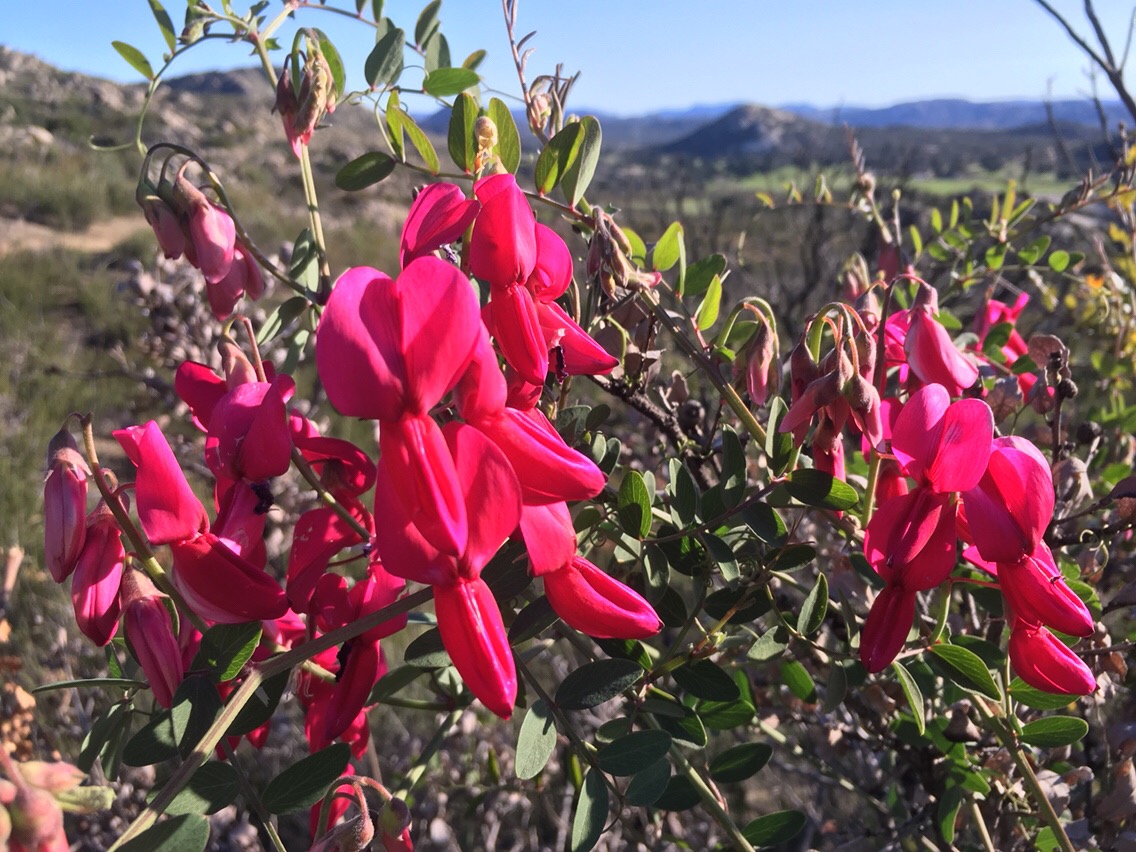
    Hiked 15.6 miles today, at mile 20.

    I saw two shooting stars sleeping under the stars in the mountain desert.  Here is a cool photo of my first camp on the PCT taken in the dark early morn.

    I’ll never get management out of my blood. Today I am reminding myself that I am in this for the long haul. I need to remember to give my body a chance to adapt. I need to establish the right routines early. For example, don’t skip flossing. It’s a small thing, but I’ll be out here for 6 months. On short hikes, I could get away with a little sunburn and a sore knee or back. Here, over a period of 6 months, the smallest thing can become chronic and make me uncomfortable for weeks or lead me to quit. I’m also getting trail organized which is different from hike preparation. I have the right things with me, but I need to keep up with them and have them where I want and when I want. It’s not a small thing. You wouldn’t believe how much time can be spent digging to the bottom of a pack to find something like sunscreen.

    After 10 miles of hiking these good intentions to focus on the long-haul went out the window. My emotional ego-centered self took over. With other hikers either waiting out the heat or slowly climbing Hauser Mountain, I had to show what a 57-year-old trail veteran could do. I zoomed up the 1000 plus vertical feet in the exposed afternoon sun. I passed younger hikers that had ducked under rocks for shade. By the time I reached the top, I felt sick. After laying in the shade, I finally managed to recover. Yep, I overdid it!

    The trail

    Rock formations were everywhere.


    Manzanita (Little Apples) I love the color of the bark.

    Prickly Pear Cactus

    Snake. First of 2 that I saw today.

    View of Lake Morena


  • Day 1 – At last!

    Day 1 – At last!

    4.6 miles today, at milepost 4.6

    I’m cowboy camping tonight under the stars. I didn’t start hiking until 5:10 pm. The entire day was spent traveling and waiting on buses. The El Cajon transit center in San Diego is a tiny bit sketchy. I had to hang out there for 3 hours waiting on the bus for Campo. Boring, but I was excited to be on this epic journey. Finally, I boarded the bus. Soon the bus was swerving back and forth on curving mountain roads. I became very motion-sick and had to focus to limit nausea; however, once off the bus and hiking, I felt great!

    The weather was pleasant. but with my quick beat-the-sunset pace, I was soon drenched with sweat. The pack weight seemed manageable even though I was loaded down with over 2 liters of water and 6 days of food. I guess the adrenaline on the first few hours of a thru-hike can make up for a lot of things (little sleep, much travel, quick pace, heavy pack).

    Here 1 am at mile one. My first mile! Yippee! Only 2649 more miles. Also, since I am matching all donations to JDRF for every mile under 2600 that I don’t finish, with one mile hiked, I’m already saving money. 🙂


    Here are railroad tracks with neat rock formations. 


  • Prepping Blog and Social Media for PCT Thru-hike

    Prepping Blog and Social Media for PCT Thru-hike

    I’ve been working a great deal over the last 6 months to dress up my blog to make it ready for my PCT thru-hike. I’ve also practiced with Instagram and Snapchat so I can hit the ground running. I’m not interested in troubleshooting or implementing new blog features while on the trail, much less trying to learn how to use Instagram or Snapchat. In the end, I’m out there to hike and I’d like to minimize my time on social media and posting blogs. The best way is to have a good system in place in advance. I’ll need to be flexible also. If it gets to be too much, I’ll need to prioritize some. Number one priority is to keep up with daily blog posts. Easily said, but it takes a great deal of dedication to keep up with after a hard day on the trail.

    I’ve just finished reading up on how to set up MailChimp to automatically email blog posts to a mailing list. In fact, this post is my first end to end test of my configuration. For anyone out there that wants to do the same with their blog, here is a great blog post on how to do it. How to use MailChimp to send WordPress blog posts by email .

    To give you an idea of some of the social media and blogging prep activities I’ve been working on, here is a partial list.

    • Setup Google Map of PCT Trail as a widget in my blog sidebar. (My hope was that you could follow my live position on the Google map.)
    • Add countdown timer of PCT start date in sidebar of blog.
    • Learn how to use Instagram, including Instagram stories and Instagram Live.
    • Learn how to use Snapchat.
    • Add Snapchat and Instagram to sidebar of blog.
    • Create blog categories for PCT-Thru-hike. Also create subcategories for major states/sections of trail.
    • Add subscribe to blog through wordpress.com (Jetpack) as widget on sidebar of blog.
    • Spend an incredible amount of time analyzing and making changes to speed up my website using  Yoast SEO (Search Engine Optimization) to identify issues to correct.
    • Adding apps on Iphone and testing to figure out fastest offline process for keeping up with blog when there is no signal
    • WordPress.com Iphone App – Troubleshooting issues with Iphone WordPress.com app and making it work with hosting site. Fixed problem, but still not good for writing offline posts and uploading (photos can’t be saved in offline blog draft). (Which is what I really want to be able to do.) For now, my plan is to just type in notes and copy and paste once I have coverage.
    • Added app to compress photos for easier upload to blog and to keep website speedy.
    • Setting up MailChimp so I can add people to my email list to automatically receive blog posts.
  • PCT Pre Hike Survey of Hardship and Suffering

    The PCT Pre Hike Survey was sent to the 351 people planning a PCT thru-hike in 2018. In all, 152 people completed the survey. 

    The PCT Pre Hike Survey consisted of 10 questions having the common theme of outdoor experience and physical preparation. It occurred to me that anyone crazy enough (myself included) to attempt a 2650 mile hike through desert and over mountains might be, let’s say “unique”.  As I expected, this appears to be a very adventurous group that is not adverse to  hardship and suffering.

    Over 44% of those surveyed have been on overnight backpacking trips for over a week, 64% more than 2 nights. This group knows what it is like to smell really bad. Just under 5% of respondents have never backpacked overnight. In my opinion, this small group must be the really courageous ones. They are setting out on a 4 – 6 month wilderness adventure without having had a single night backpacking.

    Pack weight is the key factor determining the work needed to hike mile after mile of trail, while physical shape determines how well prepared the hiker is for that work. Over 85% of hikers will have base pack weight under 25 pounds. Clearly, this group understands the importance of keeping weight at a minimum. On the pack weight front, things have improved considerably since 1973 when Bill and Nadean Myer attempted a PCT thru-hike while loaded with 96 and 64 pounds respectively at one point. They didn’t make it. (From Pacific Crest Trail Communicator, Winter 2017 edition – “No Tracks to Follow” by Bill Meyer)

    According to the PCT Pre Hike Survey, this is an active and physically prepared group with 60% routinely hiking to help in stay in shape. Running and weightlifting is tied for the 2nd among normal day to day workouts followed closely by Yoga/Stretching. My personal favorites (besides hiking), cycling and High Intensity Interval Training came in at 23 and 20 percent respectively. Be sure to review the responses for “Other” workouts. It covers a wide variety of activities from horseback riding and Jazzercise (my wife does Jazzercise too!) to Snowboarding and Arborist work. Among other activities, climbing/rock climbing seems very popular. I’d like those rock climbers nearby when I climb Forester Pass 🙂 

    The PCT Pre Hike Survey shows that 40% regularly train at a “Light Exercise” level. The PCT Pre Hike Survey defined “Light Exercise” as exercise 2 – 5 times / 1- 3 hours per week. The CDC recommends 2.5 hours per week of moderate exercise.  Approximately 85% of the PCT Class of 2018 reported exercising at or beyond CDC recommendations (Light, Moderate, or Intense). Researchers found that only 5% of Americans walk 53 minutes per day. For the 15% of PCT hikers that report little exercise (less than 2 times per week), you can be sure that once they hit the trail they will be far exceeding all CDC recommendations and in fact, soon become hiking machines.

    Several questions were intended to help better understand how much outdoor stress and hardship the PCT Class of 2018 has experienced. The shock of encountering a completely new challenge could be overwhelming for some while for others it could be what is needed for the thrill, inspiration, or feeling of accomplishment that keeps them churning out long miles. Questions covered, cold, isolation, high elevation, and treks across snow. Over 27% have hiked 2 or more continuous days through snow. There were 5 people who hiked a week or longer on snow covered trail. Over 25 percent reported hiking at elevations of 14,000 feet or greater. This is compared to my estimate of 1% of the general population.

    Method used to estimate  percent of USA residents hiking at 14,000 feet or more.

    Some have estimated that 350,000 people per year climb 14’ers in Colorado. Add in Mt. Whitney (23,000 attempts per year) and we are talking about less than 400,000 14’er climbs per year. This is about a tenth of one percent of the US population. I multiplied by 10 to arrive at my guess that 1% of US residents have ever hiked above 14,000 feet.

    Extreme cold won’t likely be a big factor in a PCT thru-hike, but it is a big indicator of how much a person has toughed it out in extremes. This is certainly a tough crowd in that 25% of the respondents reported having camped in weather colder than 10 degrees F. Among these, 18 people who had camped in subzero degree Fahrenheit temps. About 25% of respondents had never camped in temps below 30 degrees F. My guess is that they will get their first opportunity to join the below freezing club on their PCT thru-hike.

    Moving on from the physical to the mental, I considered how long a person has been alone in the wilderness in a single stretch. Many might not consider this a big deal compared to extreme cold, high elevation climbs, and difficult snow hikes, but perhaps they haven’t tried sleeping all alone with an imagination running wild at every sound heard in the dark. Other than a few hikers I have met, I don’t know anyone else that has spent even one night out alone. Nearly half of all respondents have spent one or more nights alone in the wilderness in a single stretch. There were 15% who were out for four or more nights which is in the territory of starting to have conversations with imaginary people. (Think Wilson in Castaway.)

    PCT Pre Hike Survey trail solitude is difficult

    In summary, the PCT Pre Hike Survey proves that prospective PCT thru-hikers are an adventurous lot!  Many have “seen it all” or at least “seen a great deal”.  Others may be complete newbies planning to hike their way into shape and learning as they go. The “seen it all” are better prepared for the “shock and awe”, while the newbie’s will have the most amazing adventure of their life.

    Thank you to all that participated in the PCT Pre Hike Survey. Have a great hike! I’ll see you on the trail. My start date is March 27th. Please comment and share your views and interpretations of these results.


    Link to PCT 2018 Survey Results

    Same Survey Results On Survey Monkey

  • How to keep up with Uphill on the PCT

    How to keep up with Uphill on the PCT

    I’ll keep this section updated with the latest info and resources for following my hike.

    Email of Blog Updates

    Use the MailChimp sign up form on the sidebar of my uphillhikes.com blog to subscribe to receive every blog post as an email. 

    Instagram

    Besides the blog, which I plan on posting daily, there are other easy ways to keep up with my hike. I plan on posting photos to Instagram. My Instagram user is @uphillhikes .  I will also experiment with Instagram Live so be sure to follow my Instagram feed. Right now, I’m thinking about going live when I wake up in the morning. Something like Sunrise Live. This could change, so check here as I hike for more on my social media plans.

    Google Maps

    On the sidebar you will notice a Google map of the PCT. Open it up to full size.  If you have Google Earth, you may be able to see 3D view of my current location. I’ll also add icons (the Uphill Mountain logo) wherever I camp. Click on the icon to bring up a photo of my campsite.

    If you have a Gmail Email address, you can view Uphill’s location on Google Maps Real-Time.

    To see my location on Google Maps in real-time, you need to send me your Gmail address.  Whether you use it or not, if you have a Google Account, then you should have a Gmail address. I’ll add your Gmail address to my Google Contacts and share my location with you. After I’ve added you, follow the instructions below to view my location real-time.

    See where Uphill is on PCT in Real-Time

    If someone shares their location with you, you can see them on the map.

    1. Open the Google Maps app Google Maps.
    2. Tap Menu Menu and then ​Location sharing.
    3. Choose someone.
    • To see an updated location, tap on a friend’s icon and then More More and then Refresh.


    Snapchat

    Follow me in Snapchat as well. I’m on Snapchat as uphillhikes . I may have some fun with Snapchat stories and other features.

    Here is my Snapcode.


    Twitter

    Follow me on Twitter. I might tweet a few updates in between blog posts, but I don’t plan on using Twitter extensively at this time.

    Keeping up with a blog and social media can be time consuming and it could take away from the enjoyment of the hike. I’ll use this space to let you know how and where I am using social media. It is difficult to keep up with daily blog posts at the end of a long day of hiking 20 or more miles. Try typing when your fingers are numb with cold or when you are swatting mosquitoes. Ultimately, I don’t want to forsake physical presence for virtual presence. After all, I’m on the PCT for the physical experience!

    Enjoy the hike!

    Uphill

  • PCT Thru-Hike – Top 3 Challenges

    PCT Thru-Hike – Top 3 Challenges

    Short of actual experience, one of the best ways to prepare for a PCT thru-hike is by reading PCT thru-hiker blogs.  (Read on for some of the best of these stories from 2017.)  Among other useful information, blogs will make you familiar with the hazards and challenges of hiking the PCT. However trail hardened you may be, you will likely have a rude wake-up call at some point during a thru-hike. Short of actually living it, reading other’s stories can help set expectations, perhaps reducing the shock of unexpected challenges.

    The blogs from the PCT Class of 2017 will make anyone planning a PCT thru-hike take pause. In 2017 many hikers faced fearful challenges, near-disasters, and just downright mental and physical suffering. As miserable as that sounds, no PCT thru-hike bloggers that I followed said it wasn’t worth it.

    The following are the top 3 PCT thru-hike challenges with supporting excerpts from a few of the best blogs written by the PCT Class of 2017. To check out these and many other PCT thru-hike blogs, go to Pacific Crest Trail Association and look under “Discover the Trail” for a link to “Trail Journals“. (PCTA has currently dropped its blog directory. No info on whether it will return.) If you have a good PCT 2017 blog or worst pct experience “challenge story” to share, then reply using a comment. All of us Class of 2018 PCT Thru-Hikers would love to hear it.

    As told by thru-hiking bloggers


    Mosquitoes, Heat, Personal Battles, and other Honorable Mentions

    Many worthy extreme challenges of thru-hiking in 2017 didn’t make the top 3 list. Indeed, in such a tough year, many bloggers failed to mention some pretty credible challenges. Little room was given to mosquitoes. Mosquitoes can drive you right off the trail, but I guess all things are relative. It was an extreme year for heat with bloggers making many mentions of heat. There was relentless wind in Southern California that some bloggers mentioned. A few hiking bloggers dealt with personal battles of injury, chronic stomach issues, and in more than a few cases, hangovers from recurring visits to town drinking establishments et-al.


    From nobohobos.wordpress.com

    “We were prepared with head nets, 100% deet, and clothes doused in permethrin.
    Our first encounter with these little blood suckers came in the early morning when I needed what I call 2nd breakfast. We stopped so I could eat and the mosquitoes came out of nowhere. We put on our head nets, which makes eating difficult and I quickly shoved food under my head net and into my mouth”
    Nobo Hobos, nobohobos.wordpress.com


    Number 3 – PCT Thru-hike Challenge

    Exhaustion with miles upon miles of snow-covered trail

    Walking in snow is exhausting and a PCT Thru-Hike Top pain in the #$*. In 2017, there was very little respite from the relentless day in and day out walking across mounds of snow, sun cups, slush, and the like. Long hikes across the hard scalloped surface of suncups are hard on the hiker’s feet and legs. Expect to slow Wayyyy…. down while working very long hard days to cover about half the distance you are accustomed to walking.

    There were many blog reports of timing high mountain pass crossings for early morning in order to avoid softer snow on steep climbs. The snow-covered trail also meant that most of the time, hikers were off-trail. Hikers had to frequently refer to their Guthook App (Trail map and GPS) in order to avoid veering too far from the trail. Multiple blogs recounted stories of hikers having to traverse across dangerous slopes after climbing off-trail routes while attempting passes. With switchbacks laying feet beneath the snow, the chosen route was often straight up the pass. For many, there were footsteps to follow, but some bloggers had to cut a few steps with their ice axes. Given the snow cover, there was a lot of glissading down the backside of passes.


    From pctadventure17.wordpress.com

    “All went we until the last traverse when I kicked a step too close to a rock face and post holed through (the snow melts from underneath near rocks, trees etc and an apparent solid surface ca have a massive hole underneath) that what happened I was only stopped from falling all the way down what looked like a small crevasse by a nub of rock which my foot hit. I did smash my unmentionables on the ice edge but managed to climb out with the aid of my axe.” PCT Adventure, http://pctadventure17.wordpress.com


    Number 2 – PCT Thru-Hike Challenge

    High Water Crossings

    With a record snow year in 2017 followed by warm weather, rivers and creeks were over the banks and very dangerous. Backpacker magazine featured a story of a lone thru-hiker losing his backpack and supplies when he was washed down a creek. One of the bloggers I followed very nearly lost her life when swept down a stream. There were many stories of close calls and impossible crossings. Sadly, 2 thru-hikers died drowned in 2017.


    From pctadventure17.wordpress.com

    “More river wades and the fifth day on the trot with wet feet all day – but boy was it worth it – you have to be there to fully experience the majesty of the surroundings and the backdrop of high altitude lakes and snow capped peaks.” PCT Adventure, http://pctadventure17.wordpress.com


    From Jenn Hikes , Day 67 Tuolomne River is Raging

    “By the time I got to the middle I could barely move my feet without fear of losing balance and I had nowhere to brace my poles to help steady myself. Colton turned to look at me and yelled “watch out, it’s fast there,” and started to turn back around to finish the ford to which I screamed “wait!” He forded back over to me and grabbed my arm to give me enough balance to cross.


    When we got to the other side we were both completely out of breath and so sketched out that we just crossed that. If I could have slipped, I would have been ripped downstream instantly and thrown into a crazy current and went right over Tuolumne Falls.” we reached the next bridge crossing only to find the exact same thing as the first…. a ramp underwater.”


    “…We were able to use a tree branch to hang onto to get across, but the water was chest high and pulling at us hard. We crossed over the bridge and I almost screamed when I got to the other side and saw an even worse scene. The water was speeding down our exit and was crashing waves up onto the rock we were supposed to get off on. The water was much deeper and there was nothing to hang onto. But there was no turning back.


    “I was instantly up to my chest in the current and didn’t have nearly enough strength our weight to push against it. Colton grabbed my arm and helped drag me to the rocks. I tried pulling myself up them, but my body was frozen from the icy water. I slipped and hit my head hard on a rock. I screamed and forced my body up the rocks scraping my legs up as I went.


    “We could not believe how sketchy these two bridges were. And these are bridges that are normally fully above water. We asked where they were going and they said they were heading back. They said they had spent an entire day trying to cross the next two creeks ahead of us which are supposed to be average on the difficulty scale. They had had to hike two miles upstream on the first one to cross a snow bridge that was almost gone and another three miles upstream on the next one to find a log that was icy and too unsafe for most of the group to cross. They said the water up to these points was a complete raging river with absolutely nowhere you could cross without being taken downstream. They showed us videos and it looked like a deathtrap.”


    “I shimmied across the broken bridge and when I got to the end, one of the guys threw me a rope with a caribeaner and said to clip it on and he would pull me to shore once it got too deep. I clipped it on and started walking down the stone ramp and instantly was hit with the current. I knew if I took another step I would be hurling downstream. I was terrified that the other guy wouldn’t be able to pull me in. He yelled that it was the only way, just to step off and he would pull me in. I shuffled once more, my feet completely lost all traction and I was up to my head in water. He did just what he said and pulled me in and just like that I was fine. Freezing and soaking wet, but fine.” Jenn Hikes, jennhikes.wordpress.com


    From “I almost drowned today…


    “Suddenly I was swept away by the water and caught on a nest of young trees in the middle of the creek. I still had both poles in my hands but I couldn’t stand because the force of the water was pushing so hard on me. I could barely move an inch. Plus I now had the weight of a soaking wet pack on my back as I am plastered to the little trees holding on for dear life to their branches. ……. DG, on the other side of the creek, wanted to come get me but there was no way. I was stuck in the middle of a fiercely rushing creek and he couldn’t make it to me. My hands were slipping on the branches. ……. I was becoming really scared because if I lost my grip I knew I was heading down the raging white water creek with no definitive safe way out. Even as I held on, i couldn’t move. I was stuck! I yelled to DG that I was scared. Really scared. He looked scared. The water was so much more powerful than I could fight against. Finally my fingers let go of the branches and I was swept away down the creek. I was terrified and literally fighting to survive as I was tossed and turned upside down in the narrow, rushing, tumbling white water area of the creek. I kept waiting for my body to be thrown against the rocks and each time they did and it didn’t take me completely down I bought another second. Another moment to keep my hands up and reaching for anything to grab or hold on to stop me from being pulled down the creek and against more rocks. My head was being forced under and I thought I might drown. I kept reaching out for anything to grasp onto to save myself from drowning or hitting my head. Somewhere between 200 and 300 feet down the creek I managed to grab some branches on the bank. In a complete and utter state of shock that I have never before experienced, I pulled myself to a standing position and saw Rob on the other side. ….. ran down the creek bank, scared as hell, and was so relieved to see me safe. I had no energy to move and barely mustered what was left to lay my body on the snow shelf on the edge of the creek, legs still in the water. DG was yelling for me to get out, take my wet clothes off and get warm.” Modern Gypsy Tales, moderngypsytales.wordpress.com 


    Number 1 – PCT Thru-hike Challenge

    Forest Fires

    It was a difficult call between high water and forest fire for choosing the top rank. I never read blogs with accounts of close calls with a forest fire, but there was plenty of smoke and fire. Forest fire forced more people to change plans and skip sections. Really committed thru-hikers suffer mental anguish over the thought of skipping sections, after all, the goal is to walk the entire trail. After the effort of hiking hundreds and thousands of miles, the thru-hiker nightmare is being forced to cut the hike short.

    From PCT Oregon Holy Smoke.

    “I described our experience through Oregon to someone, as if we were players in the Hunger Games. To sum it up, we spent a lot of our time running from forest fires, eating wild huckleberries and killing swarms of tracker jacker-esk mosquitos. Every evening lightning storm inevitably turned into another fire nearby, sometimes just a few hundred feet off the PCT and the sound of circling helicopters, who were just getting to the area to assess the scale of the fire, was not an uncommon sound. You can’t even tell where the smoke is coming from because it all blends together creating this cloud of smoke all around us. We were privy to running down the trail away from the smoke in those situations…” Alexa McRoberts, www.alexamcroberts.com