09 Jul Gore Ridge Trail – Copper Mountain to Frisco
On July 9th at about 7 AM, Sandra dropped me off at Wheeler Flats near Copper Mountain. I hiked about 12 miles from Copper Mountain to Frisco on the Gore Range and North Ten Mile trails. I started at an elevation around 9700 feet and reached an elevation just under 12,000 feet somewhere above Uneva pass.
I didn’t see any other hikers on Gore Range trail; however, I ran into several campers (out and back hike) just short of Uneva Pass. There were a number of hikers on North Ten Mile trail.
Logistics:
Traveling west on I-70, take the exit to Copper Mountain. If someone is dropping you off and traffic isn’t heavy, have them pull over at the far end of the exit ramp just before the bridge across I-70. The sign for the trail head is alongside I-70 just down the embankment from the road.
This is a great point to point hike for someone staying in Frisco. You come out on I-70 just opposite Main Street in Frisco.
Here is a view of Copper Mountain.
Wheeler Lakes – Take side trail off Gore Ridge trail to right about quarter mile.
Most water was easily crossed like the stream shown below. There was one boggy area at least 50 yards across where there was no choice but to plunge in over the top of my boots.
Here you can see that trail disappears in snow on hike toward Uneva Pass.
Closing in toward Uneva pass I had to cross hollowed out snow. Here you can see where I broke through, about a 2 foot drop.
West of Uneva Pass. The pass would be to the left of the photo. This is the mountain above the pass to the south.
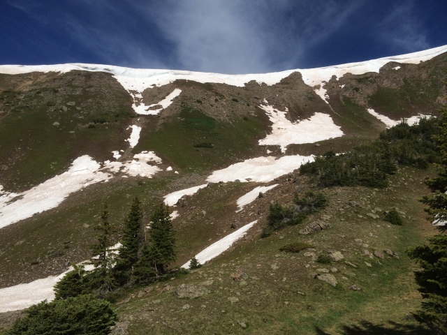
Below is a snow Cornice spanning west side of Uneva pass. I walked east on and off the trail to the smallest portion of the cornice, but decided against following some tracks over the top. The slope below was steep and there was also a small dropoff below the cornice at this point. I bypassed the cornice by crossing the slope the full length of the cornice to the north until I could make my way around the cornice well above the gap.
Below: North of Uneva Pass. Uneva pass is below and low point along ridge straight ahead. This is the point where I came out after making my way around the snow cornice.
Some snow after crossing Uneva Pass. Just northeast of Unveva Pass.
Here is an alpine lake northeast of Uneva Pass.
Cairns mark the way in the open areas beyond Uneva Pass.
Below you can see boulders strewn across grass below heavily bouldered slope. Located on descent well east beyond Uneva Pass where I am about to enter forested portion of Gore Range Trail.
Long descent toward North Ten Mile trail through sun protected forested slope had many areas of large snow piles obstructing trail. The tread of the trail was not easily picked out in many places and crossing so much snow made it difficult to know whether I was following a drainage or a trail. There was the reassurance of one set of footprints that were sometimes visible in these piles of snow.


