21 Jul Old Settlers Trail Hike (GSMNP)
May 4th, 2013 – Dodging Rain and Positioning Car
Old Settlers Trail / Gabe Mountain Trail to Campsite 34 (Sugar Cove).
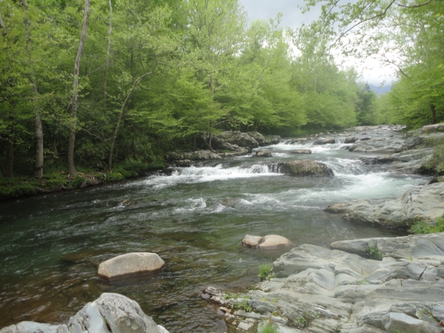
After several missed turns and a long drive, I reached the Old Settlers trailhead some time after midnight. Rolling out my sleeping bag, I slept in the back of the van and slept with the calming sound of nearby Pigeon Creek. With the first hint of light I was up and scouting out a tree to hang my food bag and cached rest of my backpack and hiking boots.
A physically demanding day lay ahead. First, I cached my mountain bike at the end of the unpaved section of Greenbrier Road. Next, I drove the 15 miles to Maddron Bald trailhead off Hwy 321 where I parked the van and started the return trip on my road bike to the Old Settlers trailhead. Along the way, I stopped at a convenience store/gas station for a big pancake breakfast and large coffee. After 12 miles, I reached the unpaved section of Greenbrier road and switched to the Mountain Bike. The road bike was left hidden in the woods and locked to a tree. After about 3 additional miles of riding I was back to my backpack and food bag. Hiding my mountain bike, I switched to hiking gear and started down the Old Settlers Trail. Old Settlers is a very long trail that with wide loops which repeatedly winds is way up successive creek valleys and back down to pick up the next creek valley. Starting out I met another hiker just starting in the same direction. He was only walking a mile or so up the trail and returning. We shared company for a while. That was the last person other than a couple going the other way about 7 or 8 miles along my 18 mile hike.
Beyond Campsite 33 the trail suddenly had a great deal of uncleared deadfall. It was so bad in places that I backtracked a little to convince myself that I was on the correct trail. I also resorted to getting a GPS reading and locating myself on the map.
Pink Lady Slippers were blooming in abundance and long mysterious piled stone walls lined the trail in places. In the solitude I wondered about the people that lived here and particularly wondered about the building of these walls. Over how many years did they pile these stones? What did they do within those walls? Perhaps raise a few cows and pigs, but maybe simply grew some corn and vegetables. The rock walls may have gradually risen as the garden was cleared of stones.
Heavy rain had been in the forecast, but other than a little shower on my morning bike ride, rain held off until I set up my Appy Trails Tarp Tent at Suger Cove campsite.

Finish 15 miles of bicycle riding. Ready for 18 mile day of backpacking, loaded with 4 days of food and fuel.
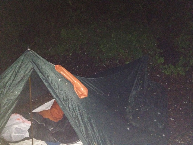
Under a very leaky tarp for a night of heavy rain.May 5th, 2013 – A Wet Night
Gabes Mountain Trail – Maddron Bald Trail near Hwy 321 – Approx 5 miles
After a wet night under a tarp (Appy Trails brand) that had been used a great deal, but not yet tested in the rain, I considered the forecast for heavy rain for the next 3 days. My sleeping bag was wet and much of what I had was muddy and miserable. The car was a tempting short backtrack of about 5 miles. I finally decided that I didn’t want another night under this leaky tarp. I packed my wet and muddy things and began the return trip up Gabes Mountain trail. A short distance from camp, I was rewarded with a drippy morning view of 2 peaceful deer moving alongside the trail.


